Arches, Chains and Toll-Houses: Six Borders Crossings You Can Walk To
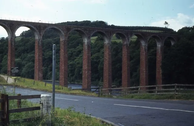
Photo: Elliott Simpson , CC BY-SA 2.0, via Wikimedia Commons
A river is a fact; a bridge is a decision. In the Scottish Borders, rivers mostly run east, roads mostly run where they must, and the places they meet have a habit of collecting stories. You do not need to be an engineer to enjoy them. You just need boots, a flask and a willingness to stand still for five minutes.
This is a loose tour rather than a strict itinerary — take them in any order, though the eastern three sit neatly together for a weekend. All are accessible on short walks, and none require anything more strenuous than a riverside path.
Leaderfoot Viaduct: the one that floats
Opened in 1865 for the Berwickshire Railway, Leaderfoot Viaduct carries nineteen arches across the Tweed on legs that look too slender for the job. Trains stopped in 1965, but the viaduct stayed, and it remains one of the most photographed structures in the central Borders — best seen, frankly, from below.
The walk: Park in the small car park at Leaderfoot, just off the A68 near Trimontium. A path drops down to the river, giving you the full upward view of the arches. Continue a few minutes upstream to Drygrange Old Bridge, a handsome 18th-century stone crossing that once carried the main road. Round trip is under an hour at a stroll.
Tea stop: Melrose, two miles east, has no shortage of cafés. The walk back along the Tweed is pleasant if the weather is behaving.
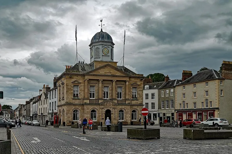
Kelso Bridge: Rennie's five arches
John Rennie's five-arch bridge of 1803 is a proper town bridge — wide, confident and still doing the job. It replaced an earlier crossing swept away by the great flood of 1797, a reminder that the Tweed has always had opinions about infrastructure.
The walk: Start from Kelso town centre and follow the riverside path downstream. The bridge looks best from the bank, where you can see how the cutwaters divide the current. Continue towards Floors Castle if you fancy a longer loop; the grounds are paid entry, but the riverside paths are not.
Tea stop: Kelso's square is well supplied. Sit outside if you can — the bridge is five minutes away and the town has a comfortable, unhurried feel.
Coldstream Bridge: the toll that divided
John Smeaton's Coldstream Bridge of 1766 was a toll crossing on the main road to England, and the old toll-house still sits at the Scottish end. The bridge is a border in the literal sense: halfway across, you are in England. It is also a fine place to watch the Tweed widen and slow as it heads for the sea.
The walk: Park in Coldstream and walk down to the river. Cross the bridge on foot for the sheer novelty of it, then follow the riverside path back. The route is short and flat — good for a winter afternoon when the light is going.
Tea stop: Coldstream has several small cafés near the bridge. The Honey Farm near Berwick is a longer detour but worth it if you are heading east.
Union Chain Bridge: iron and nerve
Opened in 1820 and restored in 2023, the Union Chain Bridge between Fishwick in Scotland and Horncliffe in England is the oldest vehicular suspension bridge still carrying traffic in the world. It is a lovely thing: slender, slightly nervous-looking, and far more elegant than it needs to be.
The walk: Park at Horncliffe or Fishwick and walk across. A circular route on the English side takes you down to the riverbank for the classic view of the chains against the sky. Allow an hour; the paths can be muddy after rain.
Tea stop: The Chain Bridge Honey Farm, a short drive away, does cakes and bees in equal measure.
Berwick Old Bridge: fifteen arches to England
Built between 1611 and 1624, Berwick's Old Bridge is a proper survivor — fifteen arches, narrow carriageway, and a history of being the only crossing here for centuries. It was superseded by the Royal Border Bridge in 1850 and the Royal Tweed Bridge in 1928, but it still carries traffic and still looks best from the quayside.
The walk: Park in Berwick town centre and walk the quays. From below, you can see the Old Bridge, the railway viaduct and the 1920s road bridge in one sweep — three centuries of engineering in a single view. The town walls are a bonus loop.
Tea stop: Berwick has plenty of choice near the quays. The walk back up through the town is short but steep in places.
Neidpath Viaduct: the railway that became a path
The Neidpath Viaduct, built in 1864 for the railway line to Peebles, crosses the Tweed just west of the town. The line closed in 1954, but the viaduct survives, and the path across it is now part of a very pleasant riverside walk.
The walk: Start in Peebles, follow the Tweed upstream past Neidpath Castle, and cross the viaduct. The round trip is about three miles, mostly flat, with one short climb. The view back towards the castle is the one to save your camera for.
Tea stop: Peebles high street, five minutes from the start, has cafés for every mood.
Before you go
Check river levels after heavy rain — paths near the Tweed can flood, and the Union Chain Bridge path gets muddy. Parking at Leaderfoot is limited; go early or use the town car parks at Melrose and Peebles. Buses connect Peebles, Melrose, Kelso and Berwick, but the eastern bridges are easiest by car.
And take five minutes to look at the water, not just the stone. The width of the river, the shape of the banks and the number of arches tell you what the builders were up against. A bridge is a decision — and in the Borders, the river always gets a say.