The Sleepers Are Gone: Four Borders Walks That Still Follow the Line
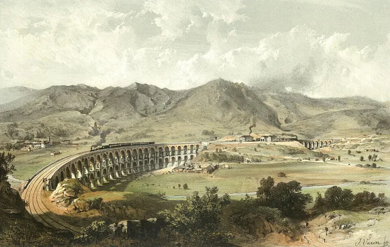
Photo: Johann Varrone, Public domain, via Wikimedia Commons
There is a particular kind of quiet on an old railway. Not the hush of a church or the emptiness of a hill, but something in between: a straightness in the path, a shelf cut into a bank, a bridge that now carries only sheep and weather. The Borders is full of these lines. Some were closed before most of us were born; others lingered into the 1960s and then went quiet. Walking them is not nostalgia for steam trains. It is a way of reading the landscape by the routes that once connected it.
These four walks are not train itineraries. They are boots-on routes that use surviving platforms, cuttings, embankments and viaducts as waymarkers. As of November 2026, access and path conditions vary, so check local signs, weather and bus times before setting out. None of these is a formal long-distance trail; treat them as heritage walks with a bit of mud attached.
Before You Set Out
Take a paper map or an offline map app. Old railway lines can look obvious on the ground and misleading on a screen. Wear boots for the rougher routes, keep dogs on leads where livestock are near, and respect any temporary diversions through farmland. Parking is limited at several of these places, so arrive early or use public transport where you can.
1. Whitrope and the Waverley Route
Where: south of Hawick, on the old Waverley Route towards Newcastleton.
Walk: about 4.5 to 5 miles out and back, depending on how far you follow the old trackbed.
Terrain: rough moorland track, uneven stone, tussocky grass and occasional wet patches. Boots are essential.
Parking and bus: small parking at the Whitrope Heritage Centre area, but check opening and access before you go. Bus links between Hawick and Newcastleton are limited, so this is easiest by car; if using the bus, plan around the return service rather than hoping.
This is the walk for anyone who wants to feel the scale of the old line. The trackbed sits high and exposed, with cuttings that still look engineered rather than natural, and long views over the hills. The big set-piece viaducts of the Waverley Route, Shankend among them, are best seen from connecting paths and viewpoints; ask locally for current access rather than assuming a right of way. What you get on foot is the sense of a railway built through difficult country because it had to be.
Afterwards: head back to Hawick High Street for an independent café or deli. It is a proper town centre for a post-walk sandwich, and the local shops reward a slow browse.
2. Peebles to Cardrona
Where: the old Tweed Valley line between Peebles and Cardrona.
Walk: roughly 3.5 to 4 miles one way, or about 7 miles there and back.
Terrain: mostly flat, with a firm surface for much of the route. This is the gentlest of the four and the best bet for a mixed group.
Parking and bus: use one of Peebles’ town car parks and walk out from there. Local Borders Buses services run in the Tweed Valley; check the current timetable for a return from Cardrona or arrange a lift. The route is also easy to shorten if the weather turns.
Peebles still wears its railway history lightly. The old station buildings and the line of the trackbed give the town a second geography once you start looking for it. The walk follows the Tweed corridor, which means water, trees and the odd bench rather than moorland drama. It is a good route for reading how a railway once threaded through a settled valley: houses close to the line, bridges over burns, and a flatness that feels almost too easy after the hills.
Afterwards: Peebles has a solid independent bakery and café scene. Pick up something for the journey home rather than settling for a service-station stop.
3. Kelso to St Boswells
Where: the old Kelso branch, running east from Kelso towards St Boswells.
Walk: about 6 miles one way. Arrange a return lift or a bus back; this is not a loop.
Terrain: field edges, old trackbed and quiet lanes, with gates and possible livestock. Expect mud after rain.
Parking and bus: park in Kelso and use a local bus service back from St Boswells, checking times before you set off. Kelso is well served for a Borders town, but Sunday services are thinner.
This is a walk for people who like their heritage half-hidden. The old Kelso station area and the line of the branch are not a theme park; they are part of the town’s ordinary edges. Out towards St Boswells, the route opens into farmland and big Borders skies. You can still pick out the straightness of the old railway in places, and the way the land has been divided around it. It is a reminder that these lines were not just passenger services but goods routes, milk trains and livestock movements: the working plumbing of the region.
Afterwards: Kelso’s independent shops and cafés around the square are the reward. Look for local produce rather than the obvious chain.
4. Selkirk to Lindean
Where: the old Selkirk branch, heading north towards Lindean and the Galashiels side.
Walk: about 5 miles one way, or a shorter out-and-back if you prefer.
Terrain: mixed path, trackbed and minor road, with some steady climbing and uneven sections.
Parking and bus: park in Selkirk and use the X95 or a local service for the return, checking the current timetable. Selkirk is a good base for a half-day walk.
Selkirk’s railway history is short and slightly melancholy: a branch that never became the through route its promoters wanted. Walking north, you get the feeling of a line that was built to connect a town rather than to rush through a landscape. The old trackbed shows up in fragments, and the views back to Selkirk and across the valley are better than a railway passenger ever deserved. It is a route for a bright, cold day when the trees are bare and the path is firm.
Afterwards: Selkirk has independent shops and cafés worth a look, especially if you have time to wander beyond the main street.
The Point of Walking a Closed Line
You do not need to be a railway enthusiast to enjoy these routes. The appeal is simpler: a path that remembers a different purpose, and a landscape that still carries the marks of it. Walk one of these lines in November, with the low sun and the wet leaves, and the Borders feels less like a place that was bypassed and more like a place that has been connected in many different ways over time. The trains are gone. The walking is excellent.